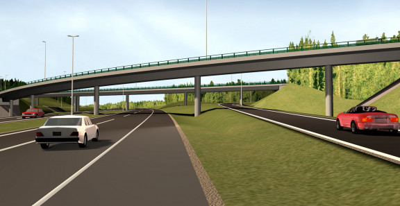
Thanks to new kinds of design and as planed models as well as tight schedules, building information modelling in infrastructure, InfraBIM developed rapidly during the design of the E18 motorway.
When the members of the Old Men’s Club Ukkokerho, a part of the Miehikkälä association of the Eläkeliitto pensioners’ union, came to the stakeholder event to hear how environmental protection had been taken into account in the design and construction of the Hamina-Vaalimaa section of E18, the listeners, tired of decades of countless, endless slides and PowerPoint presentations, were more than delighted. They were impressed both by the expert speakers, who were clearly excited about their topic and charmed their audience, and the 3D visualisations that offered an excellent illustration of the plans.
In fact, the presentation models were already in regular use when the last section of E18 was designed. Tablets and visualised models were also used in events for the general public, says Leading Consultant Juha Liukas, an infrastructure modelling expert at Sitowise.
The visual nature of the presentation models is actually something most of us connect with BIM. The model clearly illustrates the planned construction in the scenery and how the different design options and their impacts differ from one another.
Nowadays, the virtual models so admired by the Ukkokerho are created as a by-product of bim in infrastructure. However, the days when visual model images had to be created separately with great effort are not so long ago. - A visualisation was also created for the E18 Muurla-Lohja section, Juha Liukas reminisces. - Back then it required a lot more manual work than it does now.
The real turning point did not arrive until the E18 Hamina-Vaalimaa section, where the models began to be used effectively at project meetings as well, according to Matti Heikkilä, Solutions Consultant, Digital Services at Sitowise. Illustrative combined models, which make it possible to study the coordination of different types of technology, became available for common use.
- On the other hand: In the 1960s, the designs of Tarvontie were still calculated by hand according to German norms. Compared to that, this has been a gigantic leap, Juha Liukas laughs. In the following decade, computers were introduced in design – at first to calculate line geometry. The wider development of design software began in the 1980s.
Beginning from a line model
Senior Designer Jukka Elomaa, who works at Sitowise’s geotechnical department, emphasises that modelling as such is naturally nothing new in infrastructure design. “Sub soil models have been used in design ever since CityCad 3 was published, or, officially speaking, since the late 1980s.”
Jukka Elomaa himself became involved in the E18 projects in the construction design stage of the Lohja-Lohjanharju section. That was the first time when subgrade reinforcement structures such as soil replacement were modelled on a large scale. The integration of road models and geomodels in the design software could be used effectively.
In the next E18 project, the Muurla-Lohja section, the study of the use of machine control models began. String line models served as the starting point. “Until that time, cross sections were marked with sticks at work sites. People thought that it would be a smart idea if everybody used the same model and made lines in the direction of the road instead.”
But not everything turned out as planned. Olavi Janhunen, who was a project manager and the person responsible for traffic engineering on the sections of E18, remembers the confusion that arose when three consulting firms involved in the project were using three separate kinds of design software. - Still, the measurement team was happy when the consultants agreed upon a uniform set of measurement codes and terms to be used in the project. This can be considered the starting point of the current InfraBIM terminology and instructions.”
The measurement method based on string line models that was developed at the time is currently in common use.
Cooperation and innovations
Jukka Elomaa emphasises that E18 has been very important for the company’s own software development.
Along the way, our own designers made software development wishes, and people have been listening to them carefully. The tight schedules have required quick reactions, Matti Heikkilä says.
Machine control models were used on the Koskenkylä-Kotka section, and the quality of string line models was improved together with the contractor.
The development work during various motorway projects was sped up both by the customers’ needs as well as the tight schedule, which required innovative solutions.
For example, in the rocky terrain on the Koskenkylä-Kotka section, a method was needed for modelling the rock surface that varied on the cutting level and was located near the lower surface of the road structure. - The rock surface modelled on geotechnical surveys is good enough for the calculation of quantities, but it isn’t accurate enough for the machine control models created for the work machines. The solution we ended up with was that we would also deliver a model that was only intended for soil cuts to the work site. If rock comes up when excavating while using this model, the excavation naturally stops, Matti Heikkilä says.
Into everyday practice
For a long time, the development of infrastructure modelling was bogged down by the lack of common instructions and formats. Fortunately, this obstacle was removed in 2014, when the Common InfraBIM Requirements (YIV) were published. The Finnish Transport Infrastructure Agency and all major Finnish cities currently require the use of the Inframodel4 standard in new design and construction projects. The models of bridges and other special structures are delivered in accordance with the international IFC standard.
This means that in both small projects as well as massive infrastructure projects like the E18, information modelling of infrastructure has finally become a part of the everyday work of everyone involved in the project.
